Danh mục sản phẩm

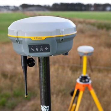
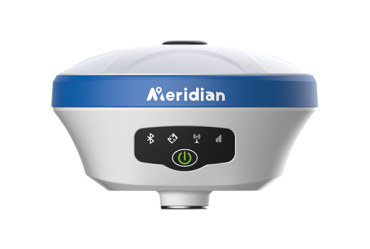
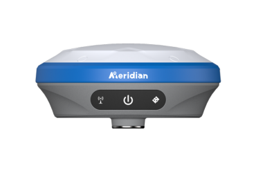
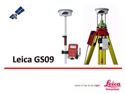
Máy định vị vệ tinh 02 tần số GNSS RTK LEICA GS09

Giá bán : Liên hệ
Máy định vị vệ tinh 02 tần số GNSS RTK LEICA GS09
our tasks, your choices, our solutions!
Are you starting a new business? Have you been considering changing to GNSS surveying? Then the Leica GS09 is the surveying system for you. Providing a simple positioning tool that grows with your business to meet all your future measurement requirements.
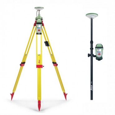
The Leica GS09 can be used in a large variety of operating modes, providing you with a complete surveying systems. Requiring only the GS09 SmartAntenna and CS09 Controller, combined with appropriate accessories, many different operating choices are available.
- SmartWorx Controller
The SmartWorx field software is based on the proven and familiar concept of the Leica System 1200. Made even easier to use with icon-based menus, ensures instant productivity.
- RTK Rover
The extremely light-weight and cable free rover is comfortable to use for the entire day. Built exceptionally rugged, the rover withstands rough use and topple overs.
- Reference Station
The easily setup RTK base station requires only the GS09 SmartAntenna, a radio modem and battery. By connecting the CS09 Controller, raw satellite data can be logged.
- Network Rover
The Leica GS09 works perfectly in all reference networks. The network corrections can be received with Leica GSM/CDMA modules or by using your mobile phone.
- SmartStation
Leica TPS instrucments can be combined with the GS09 SmartAntenna into one easy-to-use instrument
|
GNSS Technology |
Measurement Engine |
|
|
|
Leica patented SmartTrack+ technology |
|
|
No. of channels |
120 channels |
|
|
Reacquisition time |
< 1sec |
|
|
GNSS Measurements |
||
|
Satellite signals tracking |
GPS: L1, L2, L2C (C/A, P, C Code) GLONASS: L1, L2 (C/A, P narrow Code) |
|
|
Measurement Performance |
Accuracy 1 |
|
|
|
DGPS/RTCM |
Typically 25 cm (rms) |
|
RTK Rapid static (phase) Static mode after initialization |
Horizontal: 5 mm + 0.5mm (rms) Vertical: 10 mm + 0.5 ppm (rms) |
|
|
RTK Kinematic (phase) Moving mode after initialization |
Horizontal: 3 mm + 0.5 ppm (rms) Vertical: 6 mm + 0.5 ppm (rms) |
|
|
Post Processing (phase) Static with long observations |
Horizontal: 5 mm + 0.5 ppm (rms) Vertical: 10 mm + 0.5 ppm (rms) |
|
|
One-The-Fly initialization |
||
|
Reliability |
Better than 99.99% using Leica SmartCheck+ Technology |
|
|
Time for initialization |
Typically 8 sec 2 |
|
|
RTK baseline range |
Up to 50 km |
|
|
User Interface |
||
|
Keys |
On / Off key |
|
|
Led Status indicator |
Satellite tracking, Bluetooth® communication and battery power |
|
|
Communication ports |
|
|
|
Physical |
||
|
Weight |
1.05 kg including battery |
|
|
Dimension (diameter x height) |
186 mm x 89 mm |
|
|
Environmental specifications |
||
|
Temperature, operating |
-40ºC to +65 ºC (-40 ºF to +149 ºF) 3 |
|
|
Temperature, storage |
-40 ºC to + 80 ºC (-40 ºF to +176 ºF) 3 |
|
|
Humidity |
100% 4 |
|
|
Sealed against water |
IP67: Temporary submersion into water (max. dept 1m) |
|
|
Sealed against sand and dust |
Dust tight, protection against blowing dust |
|
|
Vibration |
Withstands vibrations in compliance with ISO9022-36-08 |
|
|
Drops |
Withstands 1m drop onto hard surface |
|
|
Topple over |
Withstands topple over from a 2 m survey pole onto hard surface |
|
|
Functional shock |
No loss of lock to satellite signals when used on a pole setup and submitted to pole bumps up to 150 mm |
|
|
Power management |
||
|
Supply Voltage |
Nominal 12V DC, Range 10.5 – 28V DC |
|
|
Power consumption |
Typically: 1.8W, 150 mA |
|
|
Internal Power time |
Up to 7 hours using GEB212 battery5 |
|
|
Communications |
RTK transmission |
|
|
|
Source |
Direct from GS09 (No datalogger required) |
|
RTK format |
Leica Life propriety format |
|
|
Radio Modems |
All Satellite and Pacific Crest radios in GFU or standard housing |
|
|
Integration with TPS |
||
|
SmartStation functionality |
Connects to Leica TPS1200, TS30 and TM30 instruments |
|
Leica CS09 Controller
|
User Interface |
Standard software |
|
|
|
Operating system |
Microsoft Windows CE 5.0 software |
|
Application software |
Leica SmartWorx field software |
|
|
Terminal software |
Leica SmartWorx sensor control |
|
|
Software control |
||
|
Display |
¼ VGA colour, graphics capable |
|
|
Touch screen |
Toughened film on glass |
|
|
Keyboard |
62 keys with QWERTY alphanumeric function keys |
|
|
Illumination |
Backlight illuminated display and fully illuminated keys |
|
|
Hardware |
Physical |
|
|
|
Dimension |
218 mm x 123 mm x 47 mm |
|
Weight of CS09 |
740g including battery |
|
|
Weight of pole setup |
3.47 kg for complete rover pole setup |
|
|
Weight of network rover |
2.85 kg for complete network rover using a Bluetooth ® mobile phone |
|
|
Interfaces |
||
|
Data storage |
Removable CF card (256 MB and 1 GB available) |
|
|
Communication ports |
|
|
|
Environmental Specifications |
||
|
Temperature, operating |
-30ºC to +65 ºC (-22 ºF to +149 ºF)3 |
|
|
Temperature, storage |
-40 ºC to +80 ºC (-40 ºF to +176 ºF)3 |
|
|
Humidity |
100%4 |
|
|
Sealed against water |
IP67: Temporary submersion into water (max. depth 1 m) |
|
|
Sealed against sand and dust |
Dust tight, protection against blowing dust |
|
|
Drops |
Withstands 1.5 m drop onto hard surface |
|
|
Vibration |
Withstands vibrations in compliance with ISO9022-36-08 |
|
|
Power Management |
||
|
Supply Voltage |
Nominal 12V DC, Range 11.5 – 28V DC |
|
|
Power consumption |
Typically: 1.4W, 120mA |
|
|
Internal Power supply |
Removable rechargeable Li-lon battery, GEB211 2.2Ah / 7.4V or GEB212 2.6 Ah / 7.4 V |
|
|
Operation time |
Up to 13 hours using GEB212 battery5 |
|
|
RTK specifications |
||
|
Data Formats |
Leica propriety formats (Leica, Leica Lite, Leica 4G) Optional CMR, CMR+, RTCM 2.1, RTCM 2.3, RTCM 3.0, RTCM 3.1) |
|
|
RTK baseline |
Optional 5 km maximum baseline or unlimited baseline lengths |
|
|
Position update rate |
1 Hz standard, Optional 5 Hz (0.2 sec) |
|
|
Network Rover |
VRS, FKP, iMAX, MAX, Nearest station |
|
|
External Devices |
||
|
Radio Modem |
Satellite and Pacific Crest radios in GFU housing (connected using GHT56 SmartHolder) |
|
|
Mobile Phone |
(connected using GHT56 SmartHolder)
|
|
|
GS09 SmartAntenna |
|
|
|
PC with Microsoft Windows |
|
|
|
Internet |
Mobile phone using FTP protocol |
|
1 Measurement precision and accuracy in position and accuracy in height are dependent upon various factors including number of satellites, geometry, observations time, ephemeris accuracy, ionospheric conditions, multipath etc. Figures quoted assume normal to favorable conditions. Times required are dependent upon carious factors including number of satellites, geometry, ionospheric conditions, multipath etc. GPS and GLONASS can increase performance and accuracy by up to 30% relative to GPS only.
2 May vary due to atmospheric conditions, multipath, obstructions, signal geometry and number of tracked signals.
3 Compliance with ISO9022-10-08, ISO9022-11-special and MIL-STD-810F Method 502.4-II, MIL-STD-810F Method 501.4II
4 Compliance with ISO9022-13-06, ISO9022-12-04 and MIL-STD810F Method 507.4-1
5 May vary with temperature and battery age.
Leica SmartWorx Field Software
|
Standard features |
|
Operation |
|
Always in view status information bar |
|
Permanent display of current positioning accuracy |
|
Data import: ASCII, DXF, GSI, DTM models |
|
Data export: Custom ASCII, DXF, XML, Raw data |
|
Field-to-Office data transfer using ftp |
|
Setup Reference |
|
Configuration of RTK base station for operation without requiring a controler |
|
Selection of radio channel |
|
Computation of navigated base position |
|
GPS Resection |
|
Provides a rapid localization of a GPS job |
|
Positions onto existing control points |
|
Uses a similar method as a TPS resection |
|
Requires no knowledge of coordinate systems |
|
Determine Coordinate Systems |
|
For the conversion of GNSS positions to local coordinates |
|
Provides a Onestep, Twostep or Classic 3D transformation type |
|
One point localization for rapid calibration |
|
Display and recording of parameters and residuals |
|
Automatic matching of measured and entered points |
|
Coordinate Geometry |
|
Inverse, intersections, line and arc related computations |
|
Calculations made from entered or measured points |
|
Graphical plot view of computations |
|
Coding of calculated points |
|
Survey |
|
Manual or automated point measurement |
|
Configurable display layout |
|
Point, line, area or free coding |
|
Smart and Quick coding |
|
Measuring of hidden points using offset data |
|
Stakeout |
|
Orientation to north, point, line, sun or by arrow |
|
Quality comparison between stake and design |
|
Automatic selection of closest design point |
|
Graphical selection of point from map display |
|
Design height editing during stakeout |
|
Optional features |
|
Reference Line |
|
Staking of line, arcs and polylines |
|
Staking of chainages |
|
Staking of slopes |
|
Quality comparison between stake and design |
|
Graphical display of design |
|
RoadRunner |
|
Staking of alignments: Stringlines, single/double cross slopes, batters, surfaces |
|
Graphical staking and quality control |
|
Alignments can be created in the field |
|
Importing of alignments from various design formats |
|
Comprehensive field report of completed work |
|
Volume Calculations |
|
Computation of surface areas and volumes |
|
Using imported or measured points |
|
Graphical display of triangles |
|
DXF export of measured surfaces |
|
Comprehensive reporting |
|
DTM Stakeout |
|
Staking out of height based on a digital terrain model |
|
Staking out of points with height taken from the DTM |
|
Various DTM layers can be selected for stakeout |
|
Can be used for quality control of design surface |
|
Functionality Options |
|
GLONASS satellite tracking |
|
Raw data logging for post-processing |
|
RTK functionality with unlimited baseline length |
|
Position and display update rate of 5 Hz (0.2 sec) |
|
Reference network access (includes unlimited baseline) |
|
RTCM/CMR RTK data messages input |
|
Bluetooth® mobile phone connection |
CÔNG TY MÁY ĐO ĐẠC TRẮC ĐỊA TRUNG AN
Địa Chỉ: 124/46 Phan Huy Ích , P. 15, Q. Tân Bình, Tp. HCM
Tel : (08) 38150410 - Fax: (08) 38150410
Hotline: 091 7080310 (Mr. Trung) - 0909674225 (Mr. Tín)
Email: trungankd@gmail.com
Website: http://trungan.net/